We all arrived back at Jeanette and Adel’s for a very special time of family fellowship. Jeanette and Adel provided a wonderful meal (barbecued meats and salad) followed by a pineapple cream crumble (not its proper name) for dessert. A very pleasant surprise was Nicole arriving in the afternoon! Although it was only about 18 degrees, Tom, Peter and Jemimah had a swim in the pool.
It was a very special afternoon and a delight for myself, Heather, Jeanette and Adel to have our children and grandchildren back with us again. The axiom “absence makes the heart grow fonder” could not have been more true on this wonderful Wednesday afternoon in mid-November 2022!
]]>
There was an afternoon tea at the church followed by the reception at Emu Sports Club at Leonay.
I felt deeply privileged to be asked to record the joy of the day in photos. Being the official photographer at a wedding means everyone is willing to smile. This made my job much easier!
I have captured about seven weddings in my life and even though I was required for only six hours, I found this quite an exhausting experience. For the official wedding photographer, often the day begins at 7.00 am and can go until close to midnight. Not for me at this stage of my life! I thoroughly enjoyed the experience. A good time was had by all!

 I recently purchased a new camera and lens. Olympus OM 1 + 75 mm Zuiko f 1.8. Saturday 8th October Heather and I had lunch at Windsor Seafoods prior to a photographic expedition along Windsor Mall and surrounds.
I had customised camera settings the day before which made it very easy to capture good results. The lens is amazing! The colour rendition and creamy bokeh was first class. A great benefit of this lens is its reach (150 mm in 35 mm format). It enabled me to not be intrusive (mostly) when photographing people. This lens is also great for portraits.
I was fortunate to have this photographic session as shortly afterwards the rain began and the deluge continued into the evening and following day.
]]>From Sunday 6th June we will lease the Salvation Army property to worship at their premises at Glenmore Park. We will be renting in the short term with the intention of purchasing somewhere with the sale proceeds from the Penrith properties.
In the interim period, It will be good to develop a partnership and friendships with the Salvation Army church family.

]]>
On Wednesday 11 November 2020, Dieter, Tinker and myself met Tinker’s son Peter at Sydney Boathouse at Rozelle. Peter is one of a staff of about 14 people who look after the boats of the rich and famous! It is located on Rozelle Bay with the beautiful Anzac Bridge as a backdrop. A very notable presence at Sydney Boathouse is the yacht Ichi Ban which was the overall and handicap winner of the 75th Sydney to Hobart race in 2019!
Peter very kindly spent well over an hour with us and shared much about the operations of the Boathouse. We were able to board an old timber boat being refurbished and watched a massive fork lift extricate a five tonne boat from the water to be placed in the boat shed. Photos show not only this operation but also the huge boat shed where the boats are stored. The Boathouse not only has dry boat storage (boat shed), but also on-water marina berths. They service the engines and repair the boats. Sydney Boathouse also has an onsite waterfront cafe, general store, showrooms, offices, as well as a chandlery.
Peter shared some interesting information with us. Sir Frank Lowy, Australian-Israeli businessman who created and developed Westfield Corporation, moors a number of his boats at the Boathouse. Some months ago, Israel Prime Minister Benjamin Netanyahu (close friend of Frank Lowy) arrived at the Boathouse to spend a day on the harbour with Frank. Multiple black limousines and police vehicles drove through the premises so Peter and other staff members decided to go and take a look. When they reached Frank Lowy's $800,000 boat, they were told in no uncertain terms to leave the area. Peter identified three snipers with rifles on buildings on the other side of the bay. You don't want to mess with the rich and famous!
We had fish and chips for lunch at the café before a short drive to Punt Road, Gladesville to view Rockend Cottage.
Banjo Paterson lived at and visited Rockend Cottage on and off following his school years. It was not only the residence of his grandmother Emily Mary Barton, but also of her unmarried daughters and, following the death of Banjo Paterson's father in 1889, became the residence of Banjo's mother Emily Paterson.
Banjo Paterson, original name Andrew Barton Paterson, was born February 17, 1864 at Narrambla, New South Wales, and died February 5, 1941, in Sydney. He was a poet and journalist noted for his composition of the internationally famous song "Waltzing Matilda." He achieved great success in Australia with The Man from Snowy River and other Verses (1895), which sold more than 100,000 copies before his death.
After viewing Rockend Cottage, we walked a short distance to enjoy the views at Bedlam Point. We could see Cabarita Park and baths (where I spent much of my childhood) and Canada Bay in the distance. We also observed a Rivercat silently meander along Parramatta River to Abbotsford Rowing Club on its return journey from Darling Harbour.
Bedlam Point is between Looking Glass Bay and Bedlam Bay and was chosen in the 1820s as the place where The Great North Road, which linked Sydney to the Hunter Valley, would cross the Parramatta River. A punt service which took travellers across the river at Bedlam Point was established in 1832.
There is a story about Bedlam Point. The area was named Bethlem Point as early as 1820 and was officially called Bedlam Point soon afterwards. Bedlam is a corruption of Bethlam / Bethlehem which was the name of England's first lunatic asylum. Although the origins of local naming are unclear, it certainly predates the building of the nearby Tarban Creek Lunatic Asylum in 1838.
The distance between Bedlam Point and Abbotsford is 200 metres and is the narrowest point of the Parramatta River below Homebush Bay. A cable-driven punt was established in 1832 from Abbotsford to Bedlam Point, to ferry people, produce, livestock and carriages across the river. It was the only river crossing for some thirty years before being decommissioned in 1860's.
Like myself, Tinker has a great love of history. Neither myself or Dieter were aware of Rockend Cottage or Bedlam Point even though both of us had lived in the area (myself Concord and Dieter Gladesville) at various stages in our lives.
We arrived home safely after a very enjoyable day of fellowship together. Something very special about brothers in Christ spending time together! Already planning a future trip to Barangaroo via Rivercat from Parramatta!
]]>
We arrived at Jenolan Cabins on Monday 26 October 2020. The cabins are located five kilometres from Jenolan Caves and 22 kilometres from Oberon. Misty rain and a temperature of six degrees. This was very pleasant as the Oberon countryside looks spectacular in this type of weather. The early pioneers knew Oberon as Bullock Flat. Permanent settlement in the district began in 1839 but it was not until 1863 that the name was changed to Oberon (taken from the King of the Fairies in Shakespeare's "A Midsummer Night's Dream") and it was declared a village.
On Tuesday we drove half an hour to Mayfield Gardens which is a botanical garden in the Central Tablelands of New South Wales. It is a fifteen minute drive from Oberon. the garden is one of the world's largest privately owned cool climate gardens, lying within a 2,000 hectare agricultural area. It took us 75 minutes to view everything walking at a leisurely pace. Plant varieties include Viburnum, Rhododendron, Azalea, tulip, daffodil, Hyacinth, Hydrangea, Red Oaks, Copper Beech, a large range of Maples and London plane trees to name a few.
The site was originally purchased as a working sheep farm. The story of Mayfield Gardens began in 1984. Garrick Hawkins started readying a small personal garden in 1984 in an association with local nurseryman and landscaper Peter D'Arcy. Three-decades later it evolved to become one of the largest and most expensive cool climate gardens of its kind. Mayfield Gardens initially opened to visitors in 2008, for one weekend, as a charity event. It was extremely popular.
Owned by the Hawkins family, Mayfield Gardens is open 363 days of the year. Together with the Hawkins’ Family Garden, they cover more than 64 hectares.
The Hawkins’ Family Garden is the private garden portion of the Hawkins family, which is an additional 49 hectares beyond Mayfield Garden and is open four 16 day periods each year. It features the second largest maze of its kind in Australia and plant species such as dahlias, zinnias, poppies, delphiniums, lilies, hollyhocks and lupins. The area also includes an introduced pine forest with an understory of rhododendrons and ferns, a chicken coop and a rose garden. It also has hybrid tea, wisteria, climbing hydrangea & Juniper. The heath gardens include Erica and Calluna species. The lake and boardwalk garden beds are aggregated with many types of Rhododendron and Mollis Azaleas.
Mayfield employs over 60 full-time local people across many trades, from stonemasons, painters, plumbers, welders, construction workers, equipment operators, to engineers, draftspeople, surveyors, landscapers, irrigators, marketing, event and hospitality services.
The Cunningham’s Skink (Egernia cunninghami) (you can see a photo in the photo gallery)is a sun-loving variety of spiny-tailed skink. The species is named in honour of Alan Cunningham (1791 – 1839); explorer and botanist, who collected the first specimen in the Blue Mountains. I mention this because they are so prevalent throughout the gardens. Most skinks have very smooth skin but this particular variety has spiny scales which protects them from predators in the natural environment which is predominately rocky outcrops. If a predator tried to catch them, their spines would lodge in rock crevices preventing them from being captured. I could identify them because in our early teens, myself and my brother Chris kept a variety of different lizards as pets.
]]>

17 March 2020. Kiama holds special memories for us as we have visited with our girls Jessica and Nicole many times over the years. On this occasion, we stayed three nights at Easts Beach caravan park. We drove to Saddleback Mountain, Mt Keira Lookout and the Nan Tien Buddhist Temple near Wollongong. On our third day, we visited beautiful Berry for breakfast before visiting The Treat Factory (details below). We then drove towards Kangaroo Valley to enjoy views of the Illawarra escarpment from Cambewarra Lookout.
We are living in difficult times with the Coronavirus. When fear rises, Faith sounds the battle cry. “For I am the Lord your God who takes hold of your right hand and says to you, do not fear; I will help you.” Isaiah 41:13. We have nothing to fear.
Kiama is a coastal town 120 kilometres south of Sydney in the Illawarra. One of the main tourist attractions is the Kiama Blowhole.Kiama was the site of two strong volcanic flows, called the Gerringong Volcanics, which came out of Saddleback Mountain, now a collapsed volcanic vent. The Kiama Blowhole is part of an erosion process.The Kiama headland is composed of volcanic rock called latite. A volcanic extrusion known as a dyke, cuts through the latite. The dyke is composed of a softer rock called basalt. Over millions of years the softer basalt has eroded faster than the latite creating a tunnel under the headland. Eventually part of the headland collapsed creating the Kiama Blow Hole. The Blow Hole was first described by surgeon George Bass who visited Kiama on December 6, 1797 during his examination of the coast south of Port Jackson.
During the early settlement of eastern Australia, the Kiama area was settled by wheat farmers, since the soil was volcanic and rain-swept unlike most of Australia. Early Jamberoo was the population centre from about 1830 to the 1860s and when the wheat failed to grow, the farmers switched to dairying. During this period Kiama became the best example of ‘chain migration' in Australia as many assisted migrants came from Northern Ireland on clearing leases and eventually half the marriages in the Kiama Anglican Church in a hundred years had Northern Irish Protestant ancestry. Kiama was one of the birthplaces of the Australian dairy industry with the first Dairy Factory (The Kiama Pioneer Factory) and first Dairy Co-operative in Australia.
The Treat Factory is a family business producing preserves, condiments, old fashioned confectionery and quality Belgian chocolates from recipes handed down over 4 generations.
They are the region’s largest gourmet food providor, producing more than 300 varieties of jams, marmalade’s, sauces, chutneys, dressings, chocolates, confectionery and more. Their products have a strong reputation of quality winning many Fine Food awards over the years. They are located in the historic Central Creamery in Berry, NSW, Australia. The Treat Factory is nestled adjacent to picturesque dairy fields and the historic building in which it resides and retains its original exterior and heritage charm. The heritage township of Berry is surrounded by rich dairy country, boutique eateries, wineries and is a thriving tourism destination. The Treat Factory has been operating for 25 years and grown to become a popular tourist destination on the South Coast.
The Cambewarra Lookout sits at the peak of Cambewarra Mountain, 678 metres above sea level, that's 2,225 feet if you favour the old scale. To the east, you can see right out to the coastline and will enjoy panoramic views of Coolangatta Mountain in the north all the way to Sussex Inlet in the south.
You can test your geography skills by attempting to locate all of the following Shoalhaven locations spread out like patchwork before you - Broughton Creek, Black Head, Seven Mile Beach, Seven Mile Creek, Meroo, the Shoalhaven River mouth, Crookhaven Heads Lighthouse, Berry's Canal, Crookhaven River, Greenwell Point, Beecroft Head, Terara, Point Perpendicular, Jervis Bay, Bomaderry, Cape St George, Huskisson, Nowra, St Georges Head and St Georges Basin.
]]>
We arrived in Singapore 7.30 am Thursday morning 12 March local time. Having enjoyed delightfully cool winter mornings in England, it was quite a shock to embrace 33 degree temperature and oppressive humidity.
We stayed in Changi Village Hotel which was a 20 minute taxi drive from Changi Airport. The locals are very friendly and so much is in flower throughout the Village. It has a real tropical feel but the humidity is quite overbearing.
Changi Village is a modern village situated at the northern tip of Changi which is at the eastern end of Singapore. Changi Village has its early beginnings as a Kampong Village. The place was first redeveloped by the British as a summer house and a getaway location from the city centre of Singapore, in the 1890’s, and was prized for its tranquility and remoteness.
The highlight of our visit was to walk along the Changi Boardwalk also known as Changi Point Coastal Walk. It is a 2.2km boardwalk at Changi Point and provides very peaceful views of nearby islands. Giant heritage trees such as the Damar Gajah Hiram, Tampines tree and the Malayan Rengas are visible along the way.
]]>

London was a very busy experience for myself and Heather. We drove for about forty minutes from Little Shelford and parked at a shopping centre at Walthamstow (an outer suburb of London). We then caught the underground train to Green Park station which provided us with a short walk to Buckingham Palace.
Wow! We really didn’t expect such a big crowd and the opportunity to embrace the Coronavirus. (hopefully not!). It was so busy because of the changing of the guards. I took a few photos and then we ventured along Birdcage Walk which became Great George Street to arrive at Westminster Bridge. Which afforded views of the Thames and the London Eye.
Other features we saw along the way were - St James Park, Big Ben and Westminster Abbey. The squirrels in St James Park were very special indeed!
We then walked back to Buckingham Palace where photo opportunities were freely available.
The Churchill War Rooms earlier in the day was of course the highlight of our brief trip to London. See Churchill War Rooms Gallery for photos and more information.
We only saw a small section of London but nevertheless thoroughly enjoyed the experience.
You need to stay in this beautiful city for a few days to see all that London has to offer - and . . . expect to do a lot of walking!
We had a wonderful time. Looking forward to our next visit!
]]>
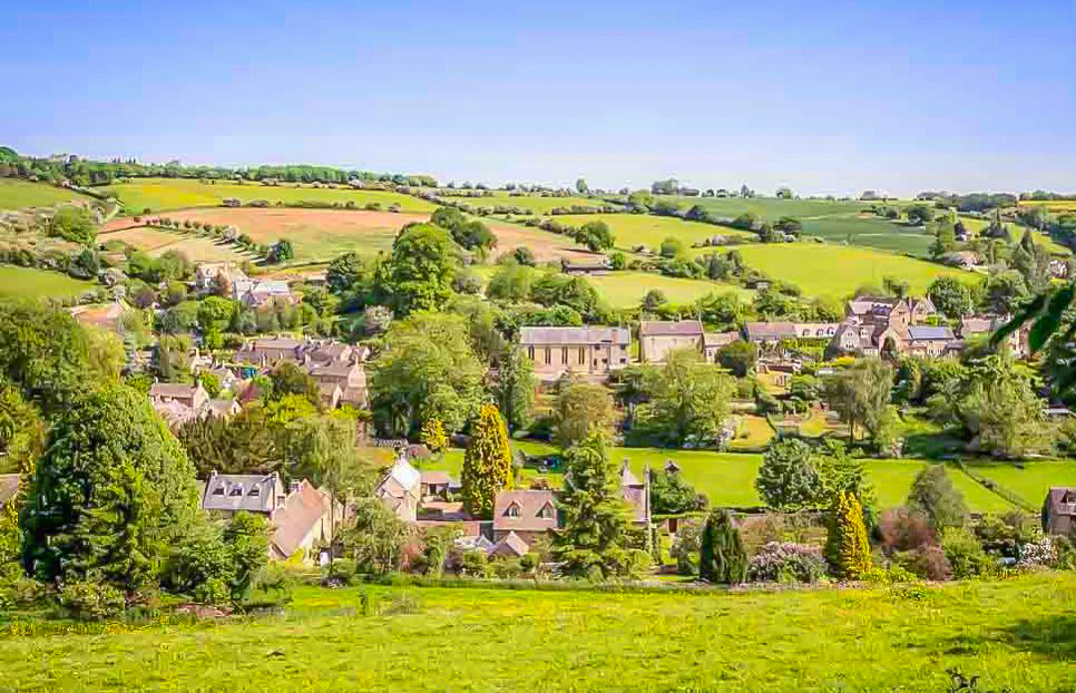 Sunday 8th March we left Oxford in the morning and drove about an hour before arriving at Burton on the Water. We then arrived a Stow on the Wold which is a bout 15 minutes away. These are both small villages situated in South England in the Cotswolds area. The Cotswolds are an area in south central and south west England comprising the Cotswold Hills, a range of rolling hills that rise from the meadows of the upper Thames to an escarpment, known as the Cotswold Edge. This is a a very beautiful part of the English countryside. Also very expensive to live there!
The Cotswolds are predominantly a rural landscape which contains stone-built villages, historical towns and stately homes and gardens. It was designated as an area of outstanding natural beauty in1966, covers 787 square miles and is the second largest protected landscape in England after the Lake District. It lies across the boundaries of several English counties; mainly Gloucestershire and Oxfordshire, and parts of Wiltshire, Somerset, Worcestershire and Warwickshire.
The name Cotswold is popularly attributed the meaning "sheep enclosure in rolling hillsides", incorporating the term, wold, meaning hills.
Bourton-on-the-Water is a village in Gloucestershire that lies on a wide flat vale within the Cotswolds area. Bourton-on-the-Water's high street is flanked by long wide greens and the River Windrush that runs through them. The river is crossed by five low, arched stone bridges. They were built between 1654 and 1953, leading to the village being referred to as "Venice of the Cotswolds.” The village dates back to the neolithic period about 4000 years B.C.
Stow-on-the-Wold is a market town in Gloucestershire on top an 800-foot hill at the junction of main roads through the Cotswolds.The town was founded by Norman lords to take advantage of trade on the roads converging there. Fairs have been held by royal charter since 1330; an annual horse fair is still held on the edge of the town.
Originally the small settlement was controlled by abbots from the local abbey, and when the first weekly market was set up in 1107 by Henry I he decreed that the proceeds go to Evesham Abbey.
An interesting tourist attraction can be found at St Edward's Church which is a medieval-built Church of England parish church. The church features a mixture of architectural styles due to additions and renovations over several centuries. The north porch is from the 17th century and masks a 13th-century moulding on the north door, which is framed by yew trees. These trees apparently inspired JRR Tolkien’s door to Moria. Although it can never be proven, JRR Tolkien was known to visit the Cotswolds so there’s good reason to believe that they were.
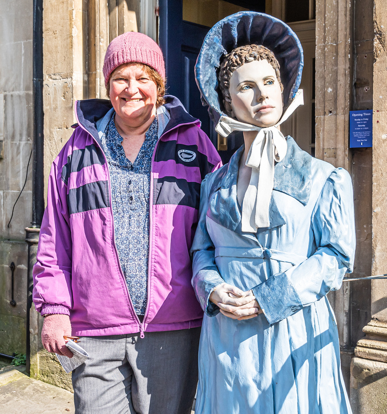
Friday 6th March we spent most of the day walking around Bath. We both thoroughly enjoyed the Jane Austen Centre and a little later visited the beautiful Bath Abbey!
The Abbey was founded in the 7th century as a Benedictine monastery. The building was rebuilt in the 12th and 16th centuries. It is one of the largest examples of perpendicular gothic architecture in the west country. When we were there a large section of the floor was undergoing restoration work due to collapse. I chatted with the Minister and he said that the floor was collapsing due to the number of graves underneath (7,000 - 8,000), where the skeletal remains were returning to dust. He also said that part of the restoration process involved channeling the hot spring water (from the nearby Roman Baths) as it travels along the Roman culvert on its way to the Avon River, as a means of heating the Abbey. Interesting to note that in the Abbey there is a plaque and Australian flag in recognition of Admiral Arthur Phillip,1st Governor of New South Wales. Arthur Phillip lived his later years in Bath and in fact died there. He would have been buried in the Abbey but his wish was to be buried in the ‘open air.’ His grave is in St Nicholas’s church, Bathampton.
Bath is the largest city in the county of Somerset, England, known for and named after its Roman-built baths. Bath is in the valley of the River Avon, 97 miles west of London and 11 miles southeast of Bristol. The city became a World Heritage site in 1987.
The city became a spa in 60 AD when the Romans built baths and a temple in the valley of the River Avon, although hot springs were known even before then. Bath became popular as a spa town in the Georgian era. Georgian architecture, crafted from Bath stone includes the Royal Crescent, the Circus, Pump Room and Assembly Rooms. Bath stone is a type of limestone that is found in the Bathampton Down Mines under Combe Down, Somerset.
Its warm, honey colouring gives Bath its distinctive appearance.
A lot of building was undertaken in bath in the nineteenth century due to the Bath Blitz. The term refers to the air raids by the German Luftwaffe on the city during World War II.
Jane Austen lived in Bath in the early 19th Century.
As an English novelist, she was primarily known for her six major novels, which interpret, critique and comment upon the British landed gentry at the end of the 18th century. Her plots often explored the dependence of women on marriage in the pursuit of favourable social standing and economic security.
]]>
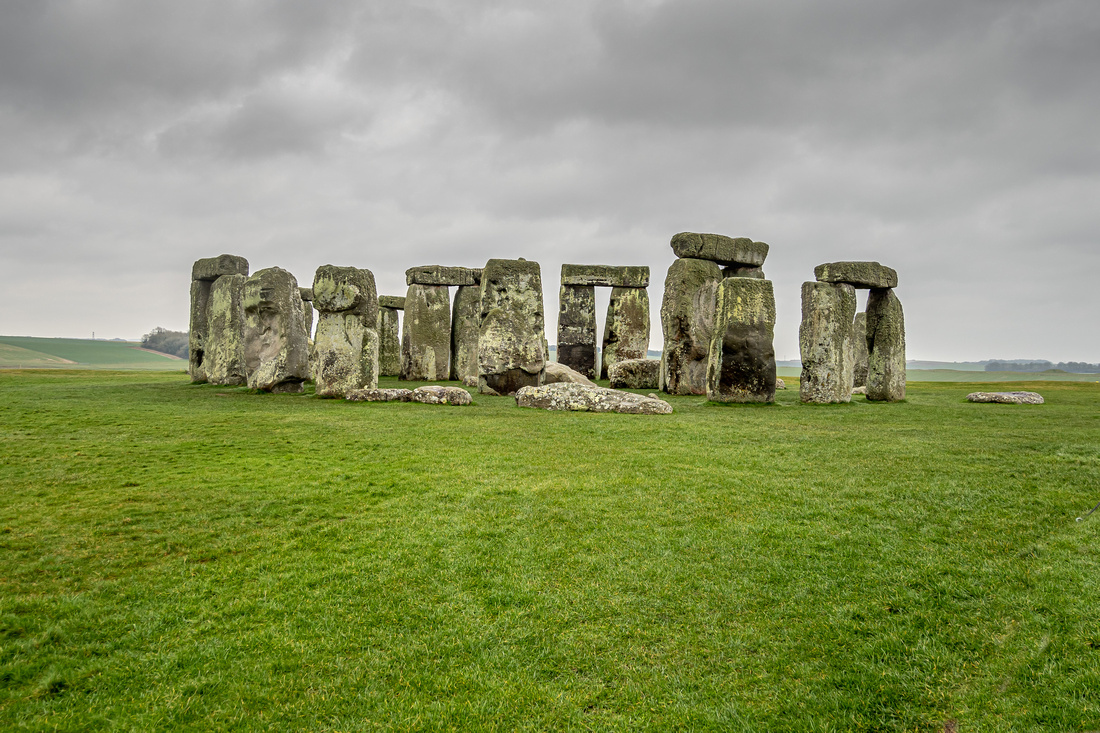
Thursday afternoon March 5, we drove a short distance from Salisbury to Stonehenge. I paid 24 pounds in freezing conditions to photograph a pile of rocks! Heather had more sense and went to the coffee shop instead. It really is a spiritual site though, and I certainly appreciated the opportunity to photograph it!
I can’t help but ask why was it built? It has no practical purpose. It was not lived in and could not have been defended, so there must have been a spiritual reason why Neolithic and Bronze Age people put so much effort into building it. This remains to be quite a mystery!
A remarkable aspect of Stonehenge is where the stones came from. The larger stones are known as Sarsen which is a very hard sandstone, small boulders of which can be found in the area around Stonehenge. But the larger Sarsen can only be found 19 miles north of Stonehenge, on the Marlborough Downs in north Wiltshire. The smaller stones are known collectively as bluestones. It is interesting that these stones are only found in the Preseli Hills of Wales which is over 150 miles to the west of Stonehenge. There is no doubt about their origin: the mineral composition of stones from Stonehenge can be matched precisely with samples from Presili.
The first part of transporting the stones would have been by land but water transport may have also been important. The River Avon, which flows close to Stonehenge, is often suggested as forming the final part of the bluestones journey from Wales.
Malcolm the shuttle bus driver said he enjoys the cold weather. My photo certainly indicates that!
]]>
 Thursday March 5 we stayed in Salisbury very close to the Avon River which has been experiencing localised flooding.
Salisbury is a Cathedral city in Wiltshire, England, with a population of 40,302. It is at the confluence of the rivers Avon, Nadder and Bourne. The city is approximately 20 miles (32 km) from Southampton and 30 miles (48 km) from Bath. The Cathedral is an Anglican cathedral in Salisbury, England. The cathedral is regarded as one of the leading examples of Early English architecture. Its main body was completed in 38 years, from 1220 to 1258.
Since 1549, the cathedral has had the tallest church spire in the United Kingdom, at 404 feet (123 m).
The Magna Carta is located in Chapter House, Salisbury Cathedral in a glass cabinet in a darkened tent. It is in the best condition of the four remaining copies. It was penned in 3,500 words of abbreviated Latin on sheepskin.
In 2015 the cathedral celebrated the 800th anniversary of the sealing of Magna Carta on 15 June 1215 at Runnymede, near Windsor. King John’s ‘Great Charter’ was a bill of rights first drawn up by his rebellious barons and later refined by the Archbishop of Canterbury.
The Magna Carta was designed to regulate the feudal relationship between the King and his subjects who were on a lesser standing than him, ensuring the Crown (and now the State) would act only by recognised procedures. The most famous of the 63 clauses states the fundamental principles of a fair trial: ‘No free man shall be taken or imprisoned or deprived or outlawed or exiled or in any way ruined . . .except by the lawful judgement of his peers or by the law of the land.’ The most significant aspect was that the King was not above the law.
The Magna Carta survived an initial annulment by the Pope, civil wars and various rewritings. The 1225 version, amended and reissued several times until 1297, still forms the basis of English law.
]]>

I really like the community spirit in Cambridge. Being a University community, there is a busyness that you would expect. I think this ‘busyness’ probably encourages, motivates and even excites the local shopkeepers and public in general. I enjoyed the ‘vibe.’ If you have watched the movie ‘The Castle,’ you will understand the importance of the vibe!
It was a very cool Tuesday morning 3rd March - 4 degrees I think. We left Tom at Trinity College as we made our way to Trinity Lane.
Heather, Jessy, Annabelle and myself walked across a bridge over the River Cam to reach Trinity Lane and the greater Cambridge Community. I enjoyed photographing the beautiful Cambridge streets (Trinity lane in particular) and the many cyclists that are the heartbeat of this vibrant city.
Before breakfast, Heather, Jessy and Annabelle walked around the Cambridge Markets as I continued to embrace my photography.
I had breakfast at Michaelhouse cafe - scrambled eggs and mushrooms on steroids. Heather, Jessy & Annabelle had fruit and cheese scones. Afterwards we went to Great St Mary’s church and I climbed the Tower which provided panoramic views of the historic city of Cambridge. On a clear day you can see as far as Ely Cathedral! The climb up the tower, was very stressful given the steep ascent and claustrophobic nature of the narrow stairwell. Nevertheless I was so pleased to get to the top to enjoy the photo opportunities.
We returned to the car via Trinity Lane after a very enjoyable Family time together.
For me, from a photographic perspective, Cambridge Community is one of the best locations for capturing the spiritual essence of the people in this wonderful community.
I look forward to returning!
]]>
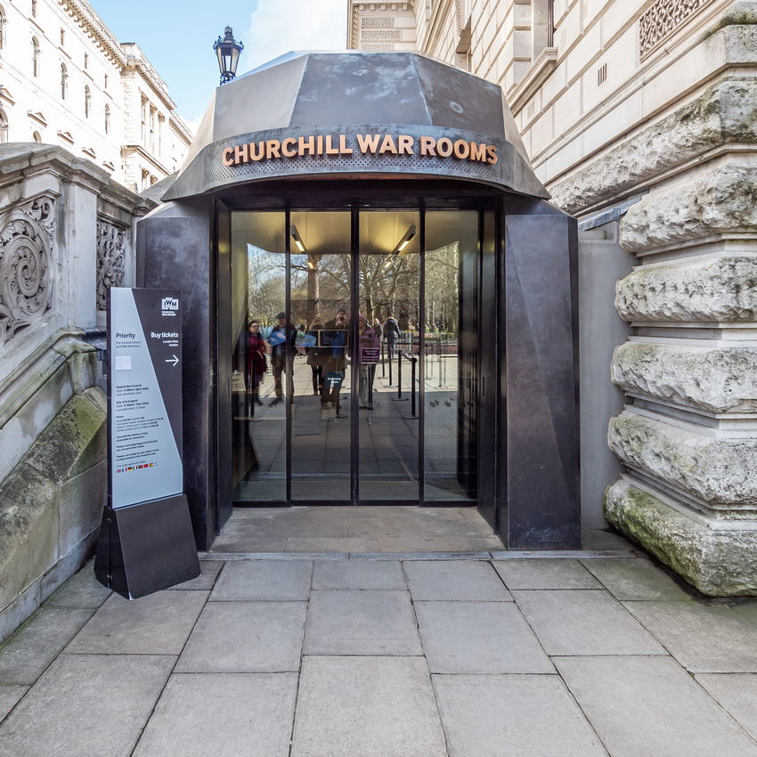
Monday 2nd March, Heather and I thoroughly enjoyed this exhibit. We only had a few hours in London so had to be judicious with our sightseeing. I captured these photos as we navigated our way around the exhibit.
The Churchill War Rooms are located in Clive Steps, King Charles Street, London. The wonderfully comprehensive exhibition on display begins in 1940 when Winston Churchill was 65 years old and war was raging across Europe.
The Second World War won Churchill his place in history. As Prime Minister, he led Britain from near-defeat to final victory. In doing so, he became a symbol of what strong leadership should be.
If his life had ended a few years before, he might have only been remembered as a brilliant failure, a controversial politician who never reached his full potential, and who made as many enemies as friends.
So glad we visited Churchill War Rooms!

Sunday 1st March - the beginning of the English Spring. Heather and I visited Anglesey Abbey with our Granddaughters Jemimah and Annabelle. The gardens are very nice but I imagine they would be spectacular in a few weeks after the spring flowering plants are in full bloom.
Anglesey Abbey is a National Trust property located in the village of Lode, 51⁄2 miles northeast of Cambridge, The property includes a country house, built on the remains of a priory, 98 acres of gardens and landscaped grounds, and a working mill.
The Priory, named Anglesey, was founded by Augustinian Monks in 1236. The priory was closed in 1536 during the Dissolution of the Monasteries which was a set of administrative and legal processes between 1536 and 1541 by which Henry VIII disbanded monasteries, priories and convents and friaries in England, Wales and Ireland.
A Jacobean style house was built on the site of the monastic ruins in 1609 by John Fowkes. The Jacobean style is the second phase of Renaissance architecture in England, following the Elizabethan style. It is named after King James I of England with whose reign (1603–1625 in England) it is associated.
The house has had various owners from 1609 until 1966. The most recent owner, Lord Fairhaven (Urban Huttleston Rogers Broughton) bought Anglesey Abbey in 1926 with his brother, Henry Broughton. When Henry married in 1932, Lord Fairhaven became the sole owner after he bought Henry’s share in the Abbey.
Lord Fairhaven continued to develop Anglesey Abbey by adding several extensions. The house and the grounds came under the care of the National Trust upon the death of Lord Fairhaven in 1966.
]]>

Wednesday 26th February we visited Sheffield Cathedral. It is the cathedral church for the Church of England diocese of Sheffield. The style of architecture is gothic and the church dates back to the twelfth century.
Sheffield is a large city in South Yorkshire. Sheffield played an important role in the Industrial Revolution with many significant inventions and technologies developed in the city. In the 19th century, the city saw a huge expansion of its traditional cutlery trade. Stainless steel were developed locally, fuelling an almost tenfold increase in the population.
Wednesday afternoon we drove to Durham which is a city in northeast England, south of Newcastle upon Tyne. The River Wear loops around the Romanesque Durham Cathedral and Norman Durham Castle.
The present cathedral was begun in 1093 and is regarded as one of the finest examples of Norman architecture in Europe.
Durham Cathedral holds the relics of Saint Cuthbert transported to Durham by Lindisfarne Monks in the ninth century. In addition, Its library contains one of the most complete sets of early printed books in England, and three copies of the Magna Carta.
Thursday morning we had breakfast in the centre of York in a very nice cafe adjacent to the cathedral. York is a historic walled city in North Yorkshire, England and was founded by the Romans in 71 AD. The centre of York is medieval. It has famous old streets (‘The Shambles’ for example) and a cathedral called York Minster.
The Cathedral and Church of Saint Peter in York commonly known as York Minster and is the second largest Gothic cathedral in Northern Europe. The title "minster” is attributed to churches established in the Anglo-Saxon period as missionary teaching churches. The present church was designed to be the greatest cathedral in the kingdom. It was built over 250 years between 1220 and 1472. In July1984 a lightning bolt hit the south transept of the cathedral causing 2.25m pounds of damage.
These three cathedrals are different in so many ways but are also very similar with regard to history, architecture and their purpose - Christian worship. On each occasion, we were met by very friendly folk who were willing to share information and show us around these beautiful cathedrals. Wherever we travel, as much as we enjoy ourselves, we experience a degree of anxiety. It could be time constraints, too much driving, struggling with a throat virus or constantly hearing about the coronavirus. The one constant during our time in the UK has been the opportunity to visit churches and cathedrals. Being 'immersed' in beautiful historic buildings and gaining knowledge in these places of worship has provided a sense of peace and food for the soul!
]]>
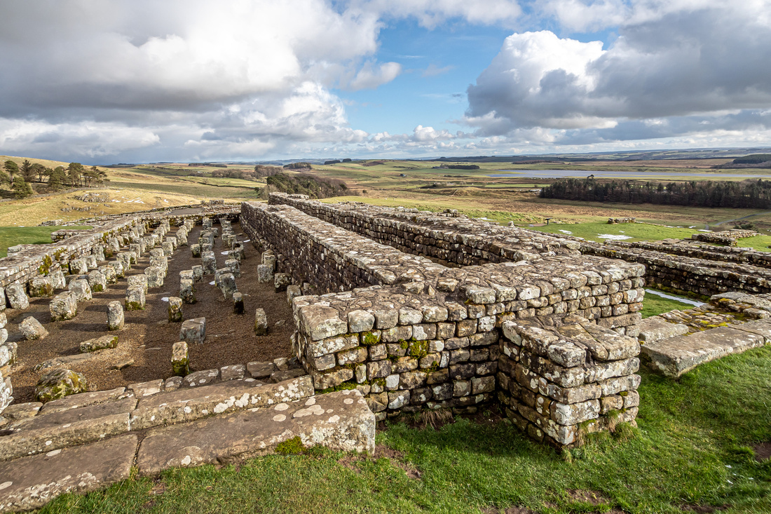 Hadrian's Wall, also called the Roman Wall or Picts’ Wall, was a defensive fortification in the Roman province of Britannia. It begun in AD 122 in the reign of the emperor Hadrian. It ran from the banks of the River Tyne on the North Sea to the Solway Firth on the Irish Sea, and was the northern limit of the Roman Empire. There were milecastles with two turrets in between. There was a fort about every five Roman miles.
By the time Emperor Hadrian came to power in 117 A.D., the Romans no longer sought to expand their territory. Instead, they wanted to protect what they had—from the Caledonians (Scotland) and others.
Under Hadrian’s orders, the Roman governors of Britain began building the wall that would later be named for the emperor to defend the part of Britain they controlled from attack. In Hadrian’s words, they wanted to “separate Romans from the barbarians” to the north - Scotland.
Scholars believe the wall may have also served as a means of restricting immigration and smuggling into and out of Roman territory.
A significant portion of the wall still stands and can be followed on foot along the adjoining Hadrian’s Wall Path. The largest Roman archaeological feature in Britain, it runs a total of 73 miles (117.5 kilometres) in northern England.
It is a misconception that Hadrian's Wall actually marks the boundary between England and Scotland. In fact, Hadrian's Wall lies entirely within England and has never formed the Anglo-Scottish border.
Tuesday 25th February we travelled from Newcastle on Tyne and drove through beautiful countryside before arriving at Chollerford which is just north of Hexham in the county of Northumberland, north east region of England. We had carrot and coriander soup at the Riverside Kitchen cafe at Chollerford (lies on the River North Tyne) before driving nine miles to Housesteads Roman Fort which is a very significant section of Hadrian’s Wall. It was built at the Housesteads Roman Fort site around AD 124.
It was a very cold day which is evident by the snow around the fort. This site is operated by the National Trust and provides much historical information. One of the best things about visiting this site however is experiencing the beautiful countryside in this north east region of England.
]]>

We awoke on Monday 24th February to rain and cold. We are getting used to English weather! Never the less an opportunity to explore this beautiful city.
Liverpool of course is famous for the Beatles.
Celebrating its 800th birthday in 2007, the city port of Liverpool actually evolved from a small fishing village on the tidal banks of the River Mersey in northwest England.
Liverpool appears to have sprung to life when King John granted it a Royal Charter in 1207. John needed to establish a port in northwest England from which he could quickly dispatch men and supplies across the sea to reinforce his interests in Ireland. As well as port, a weekly market was also started which of course attracted folk from all over the area to Liverpool; even a small castle was built.
After breakfast we visited Liverpool Cathedral which is the largest cathedral in Britain. From an architectural perspective, it looks very ordinary. However, when you walk inside, the beautiful ornate ceiling is a sight to behold!
Late morning we took the ferry across the Mersey River. Ferries have operated on this route since the 12th century. Ferry Cross the Mersey is a song written by Gerry Marsden and recorded by his band Gerry and the Pacemakers in 1964. The ferry across the Mersey has gained notoriety in popular culture because of the song.
Our intention in the afternoon was to visit Windermere in the Lake District. Unfortunately this didn’t eventuate. We had ‘car troubles’ and decided to drive to Newcastle Upon Tyne where we stayed the night. Flooding was also a concern at Windemere so a change of plans was the safer option.
As we approached Durham and Newcastle, it was evident that snow had fallen earlier in the day. A long drive from Liverpool but a pleasant end to the day!
]]>
 Our introduction to Wales was very congested traffic along the Prince of Wales bridge as we approached Cardiff and Swansea.
Friday 21st February we stayed the night at the Mecure, Swansea. So far . . . nothing attractive about Wales.
Saturday morning we drove to Aberystwyth which is in mid Wales and is an old market town and seaside resort in summer. It is also recognised as a University town. I love the narrow streets and colourful buildings!
We arrived at Glan Heulog B&B in Conwy about 6.30 pm after many miles and struggles avoiding closed roads due to flooding. An advantage of doing so much driving is that we saw so much of the Welsh countryside.
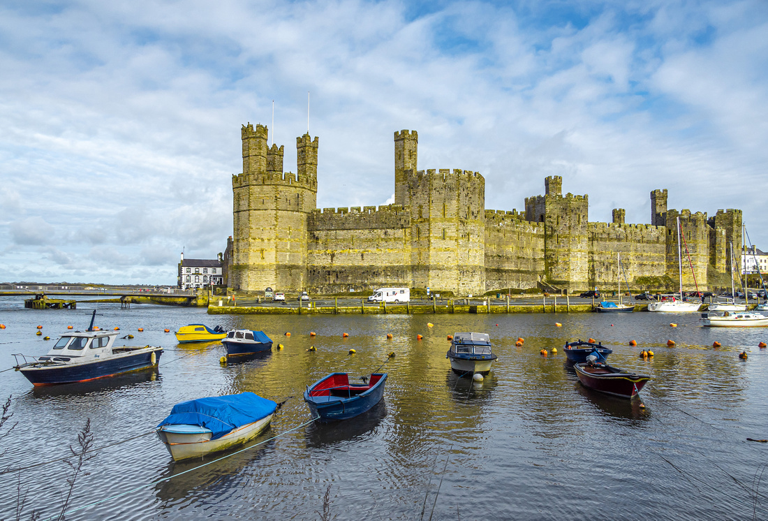
Sunday morning we photographed Conwy Castle (the Castle was built by Edward 1 during his conquest of Wales, between 1283 and 1289) before driving to Caernarfon Castle which is a medieval fortress in north-west Wales. It was a motte and bailey castle from the late 11th century until 1283 when King Edward 1 of England began to replace it with the current stone structure. Another beautiful castle!
Shortly thereafter, we visited Snowdon in Snowndonia National Park. The mountains and lake are spectacular!
We arrived at Liverpool about 5 pm. Very much looking forward to a Ferry on the Mersey tomorrow morning as well as Liverpool Anglican Cathedral which is the largest cathedral in Britain.
In our travels, sometimes we have needed to ask for help / directions from the Welsh community. I am so impressed with how these lovely people are so willing to help a foreigner! Great people indeed!
]]>
 Friday morning 21st February 2020. We arrived at Stratford Upon Avon late afternoon after a 20 minute drive from Warwick Castle.
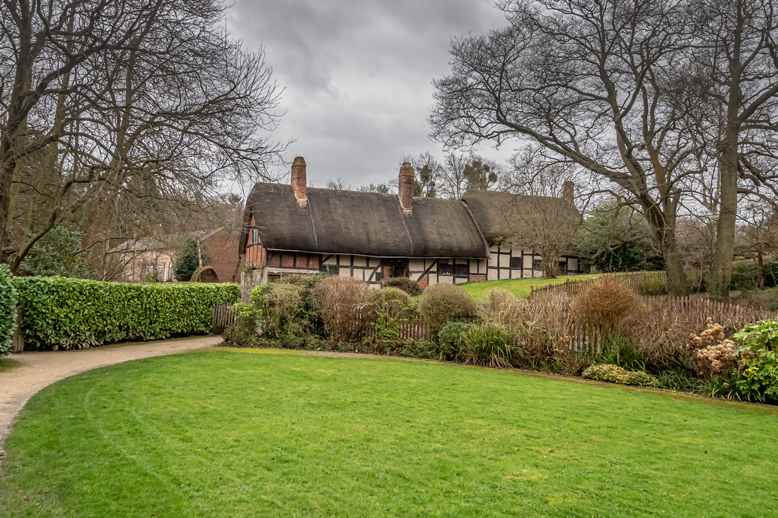
Stratford Upon Avon of course is Shakespeare country! The photos show his birthplace, Church of the Holy Trinity where he is buried and Anne Hathaway’s Cottage. Anne of course, was his wife.
I particularly enjoyed some black and white street photography as Heather and I ventured through the streets of Stratford Upon Avon in search of all things Shakespeare!
We also enjoyed a nice meal at the restaurant in the motel and the deserts – Tiramisu and raspberry ice cream and sorbet, were spectacular!
Stratford-Upon-Avon, a medieval market town in England’s West Midlands, is the 16th-century birthplace of William Shakespeare (26 April 1564 – 23 April 1616). Possibly the most famous writer in the English language, Shakespeare is known for his sonnets and plays such as 'Romeo and Juliet' and 'Hamlet'.
Anne Hathaway (1556 – 6 August 1623) was the wife of William Shakespeare. They were married in 1582, when he was 18 and she was 26 years old. She outlived her husband by seven years. Very little is known about her beyond a few references in legal documents.
The Church of the Holy Trinity, is located in Stratford Upon Avon, Warwickshire and It is often known simply as Holy Trinity Church or as Shakespeare's Church, due to its fame as the place of baptism and burial of William Shakespeare.
William is buried at the front of the church with his wife Anne Hathaway.
As I walked through the church taking photos, I thought of how Jesus expelled the merchants and money-changers in the Temple. I wonder how he would respond today with Holy Trinity Church asking for a donation to view Shakespeare's burial site and selling literature about Shakespeare in a bookshop in the church. I think it's probably acceptable for a couple of reasons. Firstly, in Jesus day, I think it was commonplace to trade in the temple to help people. Jesus expressed anger for turning the Temple into a 'den of thieves' through their corrupt commercial activities. Secondly, Holy Trinity Church is selling Christian literature as well as information about William Shakespeare. They ask for a donation rather than insisting on a 'cost of admission' for commercial gain. Interesting to note that the Church gets no Government funding as the location of where William Shakespeare is buried.
‘Life’s but a walking shadow, a poor player, that struts and frets his hour upon the stage, and then is heard no more; it is a tale told by an idiot, full of sound and fury, signifying nothing.’
(Macbeth Act 5, Scene 5). - I think William may have been feeling a little pessimistic.
]]>

Thursday morning February 20th 2020. After leaving Family at Little Shelford, We drove for about ninety minutes before arriving at Warwick. It was good to see our first English Castle. Exploring history in the UK is a great experience. Looking forward to seeing more in our travels.
Warwick Castle is a medieval castle developed from a wooden fort, originally built by William the Conqueror during 1068. Warwick is the county town of Warwickshire, England, situated on a bend of the Avon River. The original wooden motte and bailey castle was rebuilt in stone during the 12th century. During the Hundred Years War, the facade opposite the town was refortified, resulting in one of the most recognisable examples of 14th-century military architecture. It was used as a strongholduntil the early 17th century, when it was granted to Sir Fulke Greville byJames 1 in 1604. Greville converted it to a country house and it was owned by the Greville family, who became Earls of Warwick in 1759, until 1978 when it was bought by the Tussauds Group.
]]>

The University of Cambridge is a public research university about 65 miles from London. It was founded in 1209 and granted a royal charter by King Henry III in 1231. Cambridge is the second oldest university in the English speaking world and the world’s fourth oldest surviving university.
The university grew out of an association of scholars who left the University of Oxford after a dispute with the townspeople. The two ancient universities share many common features and are often referred to jointly as Oxbridge. The academic standards, history, influence and wealth of the University of Cambridge has made it one of the most prestigious universities in the world.
A very chilly Friday morning and a good day to explore the Cambridge Community. Tom is doing his PhD in Biblical Studies at Clare College. We met Tom at Tindale House (where he is based) and we did a walking tour before having lunch (beef and ale pie with mash) at the Granta pub at Cambridge which is located on the beautiful willow fringed Mill Pond. A great way to see Cambridge and the University.
]]>
 Flight SQ 222 Airbus A380 Departing Sydney Monday 10 February 4.10pm arriving Singapore, Changi 9.20pm (Singapore time) - Flying time: 8hrs 10min.
Flight SQ 322 Airbus A380 Departing Singapore Monday 10 February 11.45pm (Singapore time), Arriving London Tuesday 11 February 5.55am (London Time) - Flying time 14hrs 10 min. Total cost for airfares $17,154.00.
We arrived at Kingsford Smith courtesy of Penrith Minibus ($140) at - - - . We checked our baggage in and relaxed in the New Zealand lounge which is more modern and spacious than the Singapore lounge. The 8 hour flight to Singapore was quite comfortable and time went quickly as we read and watched a couple of movies. Business Class is so good! The food is wonderful (we could choose our meals online prior to departure.
Singapore Changi Airport is very modern and the Koi pond and natural indoor gardens are spectacular. We spent 2.5 hours in the Singapore lounge waiting for our flight to London. It was very humid (about 29 degrees). The checks and scanning as we passed through the barriers was quite stringent.
The 14 hour flight from Singapore was not as tiresome as I had expected. Being able to convert the seats to a bed enabled us to sleep in accord with London time. We probably had five or six hours sleep which greatly minimised the effects of jet lag. When we arrived at Heathrow, the checking out process was much quicker and less stringent than Singapore. We waited in the terminal for a couple of hours before catching a coach at 9am to Cambridge where Tom picked us up at about 11.30.
Return Journey:
Flight SQ 0317 Airbus A380 Departing London Heathrow Wednesday 11 March 10.55am (London time), arriving Singapore Thursday 12 March 7.50am (Singapore time) - Flying time 12hrs 55min.
Flight SQ 0221 Airbus A380 Departing Singapore Friday 13 March 8.40pm (Singapore time), arriving Sydney Saturday 14 March 7.40am (Sydney time), Flying time 8hrs.
We arrived at Heathrow at 7.45 am Wednesday morning after Tom so kindly drove the 90 minute journey. We had a nice breakfast in the Singapore lounge where we waited before boarding the flight at 11am. The journey took 12 and a half hours before arriving at Singapore. The flight was most enjoyable thanks to the lovely cabin staff. They were so polite and helpful! I entertained myself by watching two movies - Ferris Bueller's Day Off and The Philadelphia Story - yes Bizarre! We had little sleep on the flight so when we arrived at Changi Village Hotel Singapore at a little after 7 am Thursday morning Singapore time, we took advantage of the stay and had a five hour sleep. Singapore was so hot and humid!
Friday morning we went for a coastal walk before returning to the hotel for another sleep. We caught a shuttle bus from the Hotel to catch our flight at 8.40 pm. The duration of the flight was 8 hours. We arrived in Sydney at 7.40 am. It was a very mild and overcast morning. Our daughter Nicole kindly drove us home.
We cannot speak too highly of Singapore Airlines. They are extremely competent and provide an exemplary service. Just brilliant!
Time difference: Singapore is 8 hours ahead of London and 3 hours behind Sydney.
]]>
Little Shelford is a village located to the south of Cambridge in the county of Cambridgeshire, in eastern England. The River Granata lies between it and the larger village of Great Shelford. The village has one pub, The Navigator.
The Church of All Saints, Little Shelford is the village's Church of England Parish Church. The church dates from the 12th Century.
Three tablets commemorate General Sir Charles Wale, who survived many battles to die at Little Shelford in 1848; his son, who fell at the Siege of Lucknow; and his eight grandsons and great-grandsons who gave up their lives in World War 1.
Cambridge is a city on the River Cam in eastern England, home to the prestigious University of Cambridge, dating to 1209. University colleges include King’s, famed for its choir and towering Gothic chapel, as well as Trinity, founded by Henry VIII, and St John’s, with its 16th-century Great Gate. University museums have exhibits on archaeology and anthropology, polar exploration, the history of science and zoology.
]]>
 We arrived at Heathrow airport on Tuesday 11th February at 5.55am London time. We waited in the terminal for a couple of hours before catching a coach at 9am to Cambridge where Tom picked us up at about 11.30. It was very cold (about 4 degrees) and windy but so good to see Family again after four months.
I awoke about 7 am Wednesday February 12 after almost a ten hour sleep, fortunately not really feeling the effects of jet lag. A clear cool day, only three degrees at Little Shelford! After breakfast Heather and I took Peter and Jemimah to school and preschool and then we drove to Cambridge to pickup the hire car. Tom went to college about lunch time. We enjoyed pizza lunch with Jessy and Annabelle at The Deli Cafe and Bistro, Great Shelford. The artisan pizzas are quite amazing! We had a finocchiona salami, chargrilled artichoke, roasted peppers and mozzarella cheese with basil and sun blushed cherry tomatoes + grated pecorino pizza and another pizza - braised leeks, fresh thyme, gorgonzola dolce and 24 month parmesan.
I spent some time in the afternoon photographing architecture at Little Shelford including Jess & Tom’s Church All Saints Little Shelford. Lovely old colourful houses with thatched roofs. Looking forward to exploring Cambridge in the next day or so. Especially Cambridge University (Clare College) where Tom is doing his PhD.
The streets are very narrow and when driving, you often have to pull over to allow vehicles to pass. Everyone is so polite waving in acknowledgment.
We will be staying in Little Shelford for another week with Family before we begin a seven day tour of Northern England and Wales. we then return to Little Shelford for four days before touring Southern England for seven days. We have another two days at Little Shelford before flying home.
]]>
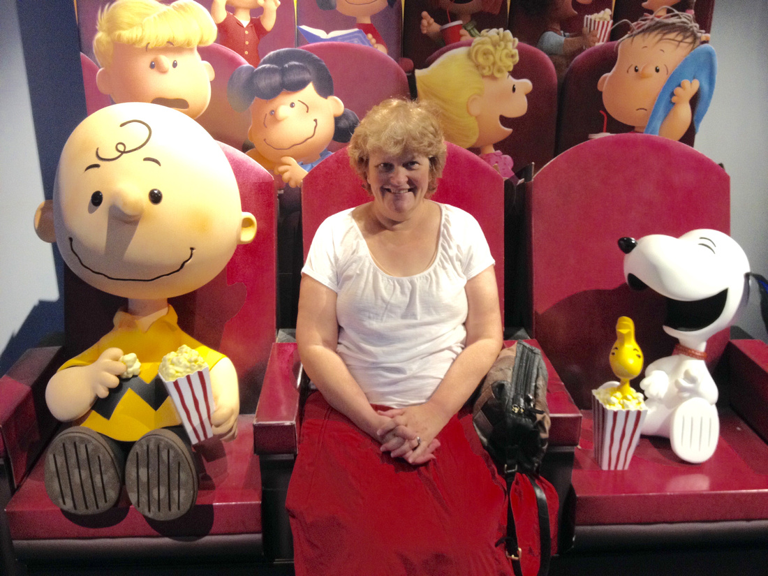
Charlie Brown and Peanuts were a pleasant part of my childhood. The wisdom of the late Charles Schulz was something that deeply impacted on me as I was growing up.
In 2017, Heather and I viewed the Charlie Brown movie at Hoyts Penrith.
It was nice to revisit my childhood!
]]>
I have included not only family in this gallery, but also friends and ‘quirky’ people who have enriched my life. It’s great to have enjoyed and endured ‘a journey’ with these people. Some acutely personal and especially rewarding.
Furry friends also because these sweet little chaps evoke positive emotions.

After lunch we took more photos of the decimated bushland and witnessed the bush regeneration that always happens after a bushfire! It was so good to see many water receptacles and food containers with carrots, sweet potato and birdseed. People have a heart for our wildlife.
Mt Banks suffered but will recover. The spectacularly beautiful Blue Gum Forest in the Grose Valley will continue to espouse her beauty!
As usual, Kel and I enjoyed each other's company. Great conversation, good coffee and of course wonderful photography!

]]>
 I love bright vivid colours. They speak to my spirit with a rich embrace of joy and happiness. Colour! What a deep and mysterious language, the language of dreams." Paul Gauguin.]]>
 I left home at 11.05 am on a cloudy Tuesday morning and filled up with petrol at Blaxland ($1.03) and bought a coffee and a very nice apple slice at Blaxland bakery.
The journey began at 11.20 am. It took 52 minutes (53km) to reach Mt Victoria and another 60 minutes (72km) to reach Capertee. Capertee had some interesting points of interest such as the service station with a large Rabbitohs poster on the perimeter of the property. There is an old historic pub and of course Pearson lookout providing a wonderful view of Pantoneys Crown.
A further 45 minutes (45km) to reach Rylstone which is a half hour drive off the main highway. It was 23 degrees at Rylstone and a little cloudy. I turned off the Castlereagh highway onto Belong Way not far past Ilford. It was a short drive (20kms) to Kandos and then a few minutes to Rylstone.
I had an egg and lettuce sandwich and coffee at Rylstone and took some photos of historic buildings before taking the Dunns Swamp turnoff near the Rylstone Hospital. It was only 25 kms to Dunn Swamp from Rylstone but I took some time stopping along the way to photograph the lovely combination of rural countryside and the rock formations in the background.
As I approached the Dunnes Swamp camping area, the soil colour changed from brown to red and the large pagoda rock formations became evident. At the entrance I placed the camping fee of $6 into the steel box. I then found Cindy from Southern Cross Kayaking to discuss kayak hire and the walks I could do in the area. I then did a little walking around the general area and took some photos. The camping area is very large and accommodates vehicles as well as caravans. It is right next to the swamp and is very scenic indeed. I can hardly wait until morning to do some exploring in a kayak! Hire is $30 for one hour and $50 for two hours.
I had dinner at 5.30pm which consisted of half an egg and lettuce sandwich and a banana. I had a picnic table to myself next to the car overlooking the swamp. As this is the second week of school holidays numbers have diminished so its not very crowded. After dinner I copied today’s photos to my Surface Pro.
As I write it is 6.29 pm (it was all but dark by 6pm) and a very mild evening. I’m laying in the Outback with the tailgate open wearing shorts, not cold at all. In fact, it’s a pleasant 18 degrees and no mosquitoes which is surprising considering I am only about 20 metres from the water! Its pretty dark but with my very bright Black Diamond head torch I can see very clearly to read maps and information about the area. My Surface Pro is also sufficiently illuminated to allow me to write this journal.
It is now 7.15 pm and I’m still quite comfortable in my shorts and short sleeved shirt. I’m wearing my new Salomon trail shoes with sock liners and wool socks. Very warm and comfortable. My head torch has two settings, one for reading and another more direct light for walking. It is quite dark now with no lighting near me. I just went to the toilet and the head torch illuminated the whole area around me. Most impressive!
The toilet sheds are very good! No smell and proper plastic toilet paper holders. They are modern and there are plenty of them scattered around.
As the senate didn’t pass the bills (yet again) that the Governments put before them yesterday, it looks likely Prime Minister Turnbull will announce a double dissolution of both houses after the budget is handed down next month, and a federal election will be held on July 2 – Heather’s Birthday!
Wednesday morning 20th April, I awoke at 6.45 am after a rather sleepless night. I slept well from 8.00 pm until 1.00 am but didn’t sleep well thereafter. It is now 7.30 am and quite misty around the swamp, a very cool 10 degrees! I took some photos and then went for a two hour walk around Ganguddy and climbed to Pagoda Lookout which afforded great views over the swamp and wonderful pagoda’s in the opposite direction.
I left Dunns Swamp at 10.45 am. (208kms distance travelled from Mt Riverview to Ganguddy). The road was Coricudgy and the first 8 kms was on gravel which is badly corrugated in parts. I had to drive slowly and therefore the 27kms to Rylstone took 44 minutes. Rylstone via Kandos on the Bylong Way to the Castlereagh Highway took 25 minutes (26kms). It was another half hour to Capertee.
The drive home had some good photo opportunities such as the rustic shed before Capertee and the solitary tree just before Ben Bullen.
 I recently visited this exhibition in the Byron Kennedy Hall, Moore Park, Sydney with Dieter and Tinker, two good mates from church.
Beginning with conception and construction, the exhibition sails through Titanic’s short, but grand life at sea including over 300 artefacts dating back over 100 years and featuring recreations of her luxurious interiors, including the Grand Staircase and First Class Cabin. Sights, sounds and smells, as well as an actual iceberg encounter, transport visitors back to 1912 to experience the opulent and excessive era of luxury steamship travel. Memorabilia from James Cameron’s 1997 blockbuster movie Titanic are also on display, including the famous “Heart of the Ocean” necklace.
My photos not only show the artefacts and recreations, but also include much history about passengers and relevant characters relating to the history of the Titanic. The exhibition opened on 8th April 2017 and will continue for a limited time. This exhibit was a thoroughly enjoyable experience. The day was particularly special due to great fellowship with Dieter and Tinker.
]]> The eye should learn to listen before it looks. When I photograph in colour there are many distractions. Monochrome however, allows me to see at a deeper level. For me, black and white photography is a mix of tough simplicity and easy complexity. The oldest of vintages and the freshness of a new season.
]]>
 We left Richmond early morning to visit Peter Rabbit Garden at Riversdale Estate on our way to Hobart. Mount Field National Park is 64 km northwest of Hobart via New Norfolk.
Mount Field National Park was created in 1916 as one of Tasmania’s first national parks in order to protect Russell Falls and the surrounding forests. The landscape ranges from eucalyptus temperate rainforest to alpine moorland, rising to 1,434 metres at the summit of Mount Field West. It is interesting to note that in 1899 Russell Falls were selected as one of eight images to be used on a set of pictorial postage stamps, aimed at promoting the then colony's growing tourist industry.
Our purpose for visiting Mt Field NP was to view and photograph Russell Falls, Horseshoe Falls and Lady Barron Falls. At the rear of the information centre we proceeded up the trail to the edge of the rainforest where a larger sign lists the hiking times to Russell Falls (25-minute return), Horseshoe Falls (45-minute return), Tall Tree Walk (75-minute return), and Lady Baron Falls (2 hour 30-minute circuit). We did the full circuit and enjoyed changes in forest types as we visited all three waterfalls. The walk passes through towering swamp gums and species typical of wet forests and cool temperate rainforests such as dogwood, musk and myrtle. We ascended and descended a little over 100 metres along the way as we enjoyed the cool rainforest and dry forest. Each rainforest had its own character and well worth a visit.
On the way back we battled our way through Hobart peak hour traffic as we drove to the summit of Mt Wellington. The mountain is the summit of the Wellington Range on whose foothills is built much of the city of Hobart. The mountain rises to 1,271 metres (4,170 ft) above sea level and is frequently covered by snow, sometimes even in summer, and the lower slopes are thickly forested, but crisscrossed by many walking tracks and a few fire trails. The narrow road to the summit is sealed and about 22 kilometres from Hobart central business district. An enclosed lookout near the summit provides spectacular views of the city below and to the east, the Derwent estuary and also glimpses of the world heritage area nearly 100 kilometres west. From Hobart, the most distinctive feature of Mount Wellington is the cliff of dolerite columns known as the Organ Pipes.
When we visited it was 15 degrees at 5.30pm but with the bitingly cold wind it felt much colder! Surprisingly there were many tourists at this time of day. I was fortunate to be there at the right time of day to capture a team photo of a local Aussie Rules team on the summit with Hobart in the background!
]]> Binalong Bay is a small coastal town in north-east Tasmania, situated at the southern end of the Bay of Fires. Originally a fishing hamlet, the town is now a village with a large proportion of holiday dwellings. It is 1 kilometres north of St Helens which is where we stayed for two nights. Binalong Bay is quite unique with turquoise-coloured ocean breaks and a beautiful white beach fringed with huge boulders draped with iconic orange lichen.
A short forty minute drive from St Helens provides easy access to two beautiful waterfalls - St Columba and Halls Falls.
St Columba Falls is situated in St Columba Falls State Reserve and features beautiful forests and the cascading waters of the South George River that plunge over steep granite ledges. Surrounded by densely wooded hills, this reserve contains forests of tree ferns, sassafras, myrtles and beech, and provides a massive water catchment that flows year round. The area was prime habitat for Tasmanian Tigers, once Australia's largest carnivorous marsupial. A short walking track through the forest leads to a viewing platform at the base of the falls. The short walk through the forest is quite stunning with so many tree ferns before arriving at the waterfall.
Halls Falls is only a couple of kilometres down the road from St Columba Falls and is situated in Pyengana. The walking track, is a 90-minute return stroll through a dense forest of towering eucalyptus trees and centuries-old ferns to an historic weir built by timber workers in the late 19th century. The walk is along a well maintained track and becomes steeper closer to the waterfall. The lookout doesn't provide a particularly good view. A further five minute walk downhill to the river bank is well worth the effort as the view is quite spectacular. Although this is only a small waterfall, it is very pretty and one of the best I have seen! The region around Halls Falls pays tribute to Chinese Tin Miners that worked the area in the 1800's.
Whilst in the area we visited the Pyengana Dairy Company farm and Holy Cow Cafe which is on St Columba Falls road. Pyengana is an Aboriginal word meaning the meeting of two rivers and the Pyengana Dairy Company sits in this lush river valley favoured by dairy farmers. The company is a working dairy farm and makes many types of cheeses which it sells to the public. Cheese tastings were being held when we were there and it was a delightful place to stop for a coffee or milkshake. On a farm just down the road, someone had left the gate open as we encountered many healthy looking cows wandering across the road!
]]>
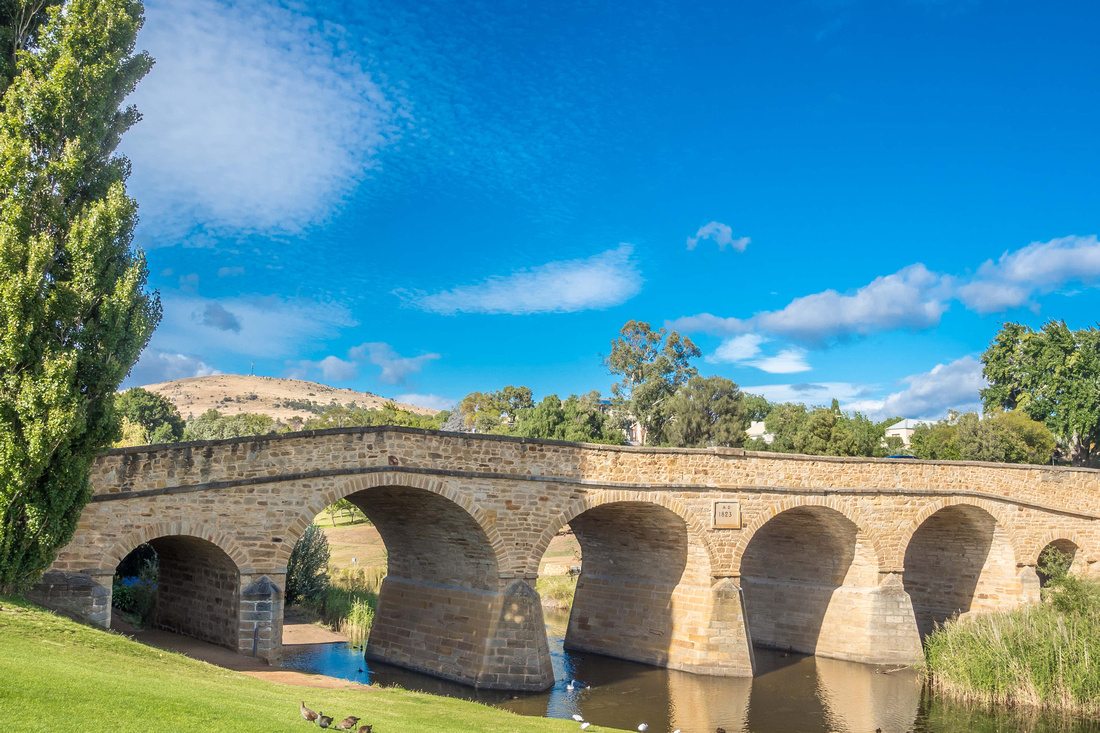 Richmond is a picturesque and historic town in the heart of the Coal River Valley wine region and tells the story of an early Australian colonial village. It is situated about 25 km north-east of Hobart, in the Coal River region, between the Midland Highway and Tasman Highway. Of course, Richmond is famous for the beautiful heritage listed arch bridge.
The Richmond area was explored within weeks of the establishment of the first European settlement at Risdon Cove in 1803. Lieutenant John Bowen and a small party crossed the hills from the Derwent Valley and entered the valley where the Coal River and Richmond are now located. Members of Bowen's party found small deposits of coal in the river and it was appropriately named.
Soon afterwards land was granted and settlers moved into the district. The success of wheat crops in the area was almost immediate and as early as 1815 a flour mill had been built to process the harvest. Until the 1830s the Coal River valley was known as the granary of Van Diemen's Land
It wasn't until 1824 that the settlement of Richmond was named by Lieutenant Governor William Sorell and a 36 ha site was set aside for the development of the town. By this time the bridge across the Coal River (one of the most photographed bridges in Australia) was already under construction.
For some years Richmond had been used as a crossing point for people travelling by land to the Tasman and Fleurieu Peninsulas. The need for a bridge across the Coal River was obvious as early as 1820 when the Royal Commissioner John Thomas Bigge recommended it. When the Coal river was in flood access to the East coast was greatly restricted. The bridge was completed in 1825. Major repairs were needed in 1828 and 1884.
It is the oldest bridge still in use in Australia and the oldest stone span bridge in Australia. In 2005, the bridge was recognised as an outstanding historic place and added to the Australian National Heritage List. The foundation stone was laid on 11 December 1823 and construction continued using convict labour until completion in 1825. The bridge was originally named Bigge's Bridge after Royal Commissioner, John Thomas Bigge, who recognised the need for the bridge in 1820. Although the designer is unknown, it may have been colonial architect David Lambe or Major Thomas Bell, the engineer in charge of public works.
In 1832, an employee of the Richmond Gaol was murdered at Richmond bridge. George Grover was employed as a gaoler whose duties including flogging the prisoners. He was unpopular due to his ferocity and was pushed off the edge of Richmond Bridge after drunkenly falling asleep. No one was convicted of his murder.
It is interesting to note that the oldest bridge on mainland Australia is Lennox Bridge which is five minutes from me at Blaxland. It is also a stone arch bridge and was designed by David Lennox a Scottish-Australian bridge builder and master stonemason. Lennox Bridge was opened in 1833.
Heather and I stayed three nights at Richmond in The Old Stables which is part of Ivy Cottage which was built c 1830. It had a nice colonial feel to it and a very pleasant place to stay. Richmond was a good place to base ourselves to visit other parts of Tasmania in this region. However, for me, I felt Richmond was a little contrived and over-commercialized. The following is an article written by a Sydney Morning Hera;d travel writer in 2008. I concur with his sentiment!
"There must have been a time when Richmond was one of the most charming places in Australia. Set in gently undulating country on the banks of the Coal River it has no fewer than 45 buildings listed on the National Estate and, in many ways, it is a town which has been held in time. Unfortunately its proximity to Hobart (which is only 27 km away) has ensured that it has become one of the most popular tourist attractions in Tasmania. This has meant that old Georgian stone houses, commercial buildings and hotels have been converted into gift shops, Devonshire tea places, restaurants, craft shops, and museums.
Perhaps the best symbol of the change is the fact that the local gaol sells plastic balls and chains. Given that the original convicts were forced to wear balls and chains which weighed up to 20 kg and which were sometimes welded onto their ankles for years, it is hard to see this commercialization as anything other than a disregard for the suffering of the people who, through their unwilling labours, made this tourist town possible.
Add to this the fact that most of the buildings in the town have been painted and scrubbed and you are left with the overpowering feeling that what you see at Richmond is not historic buildings but tea rooms and gift shops in the shells of old buildings. There is little doubt that people wanting to experience what these beautiful old villages were like in the early nineteenth century would be much better served by a visit to Ross or Oatlands.
In spite of the reservations about its over-commercialization, there is little doubt that Richmond is a remarkably well preserved Georgian township which offers a rare insight into the types of buildings which some of Australia's earliest settlers lived in, were incarcerated in, prayed in and drank in. The reason that so many of the buildings remain in good condition is largely a result of the construction of the Sorell Causeway. In 1872, when the causeway was completed, Richmond's role as a major staging post on the way from Hobart to Port Arthur disappeared. It was by-passed and mercifully the historic buildings remained largely intact."
]]>
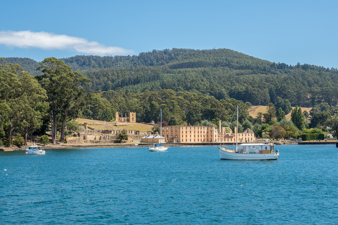 Port Arthur is a small town and former convict settlement on the Tasman Peninsula. It is one of Australia's most significant heritage areas and an open-air museum. Port Arthur is officially Tasmania's top tourist attraction. It is located approximately 60 kilometres south east of Hobart. In 1996 it was also the scene of the worst mass murder event in post-colonial Australian history.
Port Arthur was named after George Arthur, the Lieutenant Governor of Van Diemens Land. The settlement started as a timber station in 1830, but it is best known for being a penal colony.
From 1833, until 1853, it was the destination for the hardest of convicted British criminals, those who were secondary offenders having re-offended after their arrival in Australia. Rebellious personalities from other convict stations were also sent here, a quite undesirable punishment. The prison was completed in 1853 but then extended in 1855.
The peninsula on which Port Arthur is located is a naturally secure site by being surrounded by water (rumoured by the administration to be shark-infested). The 30m wide isthmus of Eaglehawk Neck that was the only connection to the mainland was fenced and guarded by soldiers, man traps and half-starved dogs.
Contact between visiting seamen and prisoners was barred. Ships had to check in their sails and oars upon landing to prevent any escapes. However, many attempts were made, and some were successful. Boats were seized and rowed or sailed long distances to freedom.
Port Arthur was sold as an inescapable prison, much like the later Alcatraz Island in the United States. Some prisoners were not discouraged by this, and tried to escape. Martin Cash successfully escaped along with two others. One of the most infamous incidents, simply for its bizarreness, was the escape attempt of one George "Billy" Hunt. Hunt disguised himself using a kangaroo hide and tried to flee across the Neck, but the half-starved guards on duty tried to shoot him to supplement their meager rations. When he noticed them sighting him up, Hunt threw off his disguise and surrendered, receiving 150 lashes.
Before Port Arthur was abandoned as a Prison in 1877. After the Prison closed much of the property was put up for auction. However, most of the property was not sold until 1889. By this time, the area had become increasing popular and the prison buildings were in decay. As the Hobart Mercury proclaimed, "the buildings themselves are fast going to decay, and in a few years will attract nobody; for they will be ruins without anything to make them worthy of respect, or even remembrance.
The decay was seen as something positive as the Tasmanian population wished to distance themselves from the dark image of Port Arthur. Those who bought Port Arthur property began tearing down the buildings, the destruction was furthered by the fires of 1895 and 1897 which destroyed the old prison house, and earth tremors. In place of the Prison Port Arthur, the town of Carnarvon was born. The town was named after the British Secretary of State and the population was said to be "refined and intellectual." The town brought in many visitors as they encouraged boating, fishing and shooting in the natural beauty of the Peninsula. They again wished to remove the negative connotation attached to the area.
In 1927 tourism had grown to the point where the area's name was reverted to Port Arthur. 1916 saw the establishment of the Scenery Preservation Board which took the management of Port Arthur out of the hands of the locals. By the 1970s the National Parks and Wildlife Service began managing the site. In 1979 funding was received to preserve the site as a tourist destination, due to its historical significance.
On 28 April 1996, the Port Arthur historic site was the location of a tragic killing spree. The subsequently convicted perpetrator murdered thirty-five people and wounded twenty five more before being captured. The killing spree led to a national restriction on high capacity semi-automatic shotguns and rifles. The perpetrator Martin Bryant is currently serving thirty-five life sentences plus 1,035 years without parole in the psychiatric wing of Risdon Prison in Hobart, Tasmania.
12 years has elapsed since Heather and I had visited Port Arthur with our girls. I found it particularly sad on this occasion, as we inspected the memorial garden and pond which commemorates the victims of the 1996 massacre. I remember when we visited in 2005, even though this was nine years after the event, there were signs in the cafeteria requesting that the public refrain from asking questions as staff members who had witnessed this horrible event still worked there. This is such a tragic place on so many levels!
]]> On the way to Cradle Mountain from Devonport, we viewed Mt Roland near the village of Sheffield. This mountain appeared quite majestic when viewed from the rural setting of Sheffield.
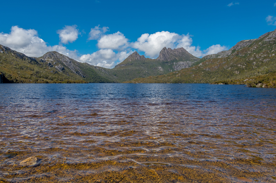
Tasmania's iconic Cradle Mountain is in the central highlands region and located 144 km from Launceston and 83 km from Devonport and is the central feature to the Cradle Mountain - Lake St Clair National Park, which is part of Tasmania's World Heritage Listed area. It is situated in the Cradle Valley which has evolved slowly, the most obvious plant community is Buttongrass moorland which favours the high rainfall of 2800 millimetres per year.
At 1,545 metres (5,069 ft) above sea level, it is the fifth highest mountain in Tasmania. Cradle Mountain is composed of dolerite columns, similar to many of the other mountains in the area. It rises above the glacially formed Dove Lake. Cradle Mountain was named by Joseph Fossey in 1826.
Gustav Weindorfer was a pioneer of the Cradle Mountain region. Born in Austria in 1874, Gustav Weindorfer came to Australia in 1900. He met Kate Cowle in Victoria and they both moved to Tasmania where they married in 1906, spending their honeymoon on Mount Roland.
They bought a 100 acre farm at Kindred and settled down to farming. In 1909 Weindorfer and Charlie Sutton camped at Dove Lake and on the 4th of January 1910 Gustav, Kate and Ronnie Smith climbed Cradle Mountain. Kate Weindorfer thus became the first white woman to climb Cradle Mountain.
According to Ronnie Smith, as they rested on the 1545 metre summit Gustav Weindorfer proclaimed "This must be a national park for the people for all time. It is magnificent, and people must know about it and enjoy it."
Gustav Weindorfer bought land in Cradle Valley in the late summer of 1910. In 1912 he started building his alpine chalet Waldheim, which means "forest home" and received his first guests in late 1912.
Kate Weindorfer died in April 1916 and Gustav Weindorfer died in May 1932, but during his lifetime his vision of a National Park became a reality when in 1922 an area of 158,000 acres from Cradle Mountain to Lake St.Clair was proclaimed a "Scenic Reserve and Wildlife Sanctuary."
The short walk around Dove Lake is necessary to view Cradle Mountain from many different angles. The best views however (most photographed by tourists), is from the boat shed on Dove Lake with Cradle Mountain in the background. Heather and I enjoyed the views on a cool, crisp February morning.
]]>
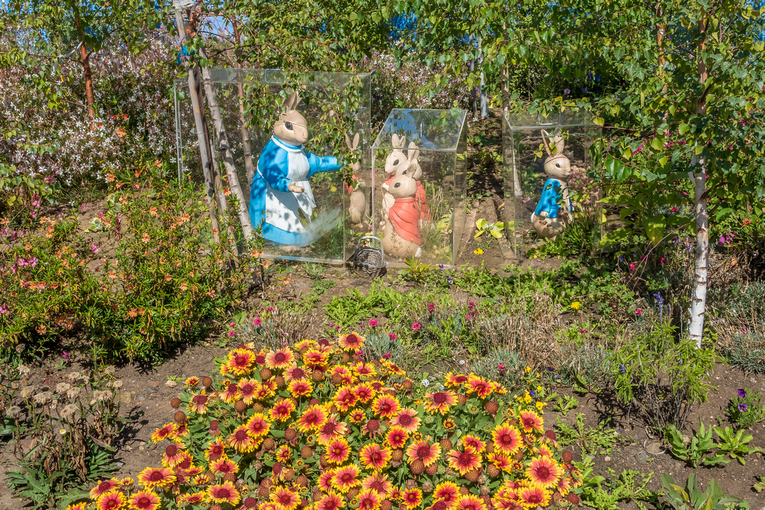 Peter Rabbit Garden is located in the Coal River Valley on Riversdale Estate just a short drive from Hobart. Peter Rabbit Garden was created and inspired by Beatrix Potter's illustrations from her books, sketches, letters and journals. The design of the garden and all the items for sale had to conform to the requirements of the Beatrix Potter Society, and is the only Peter Rabbit Garden of its type in the Southern Hemisphere!
If you don't know much about Beatrix Potter, do a google search or watch the recent movie about her life - 'Miss Potter' starring Renee Zellweger as Beatrix Potter and Ewan McGreggor as Norman Warne. She was such a remarkable lady. An extremely talented artist but also a conservationist (the Lakes District) well before "saving the planet" was on anyone's agenda.
When our daughters, Jessica & Nicole, were little, we read Beatrix's books to them on a weekly if not nightly basis.
Mrs Tiggywinkle lived in our backyard. Every Easter, she provided Jess and Colie with much joy as they discovered the chocolate eggs that she so lovingly gave to them. Always located behind the Turpentine tree stump. I'm sure she had a helping hand from Peter, Benjamin, Flopsy, Mopsy and Cottontail. Oh, and of course Mrs Rabbit!
Suffice to say, the easter bunny was never required at our place.
]]>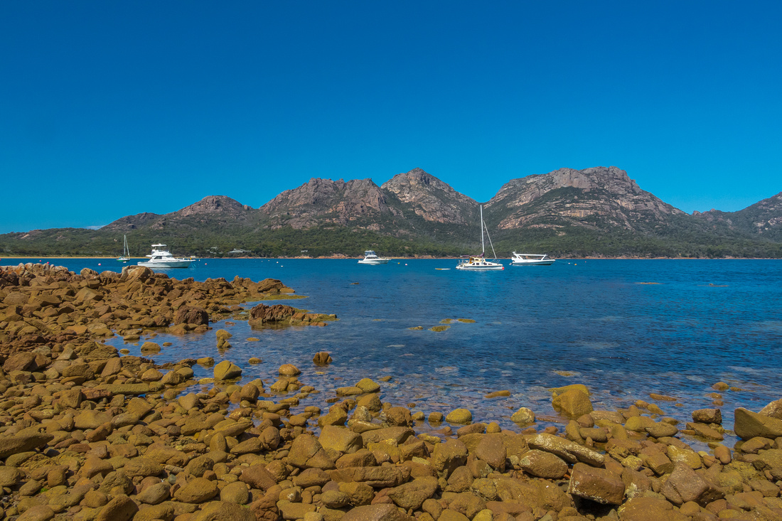 Coles Bay and Wineglass Bay are part of Freycinet National Park which is situated on Tasmania's east coast. The Freycinet peninsular looks out to the Tasman sea from the eastern side and back towards the Tasmanian coastline from the west. Coles Bay sits beneath pink granite mountains overlooking Oyster Bay. It is situated 192 kms north-east of Hobart and 209 kms south-east of Launceston. It is a very sleepy beautiful little town and for us, a lunch stop on our way to Wineglass bay.
Heather and I decided to opt for the climb up to Wineglass Bay Lookout which is a steep uphill walk on a rocky but well constructed track. The rock type along this walk is granite. Although not common in Tasmania, granite forms some spectacular features in Freycinet National Park. The view from the lookout is quite good. However, if we return in the future, the longer walk to the beach (Isthmus Track Circuit) will no doubt provide better views and a much more enjoyable experience. This is a very beautiful part of the east coast and more than a day is required to fully appreciate all it has to offer. I would love to return with camera in hand to photograph a sunset!
]]> In the north-east of Tasmania, the magnificent mountain of Ben Lomond, with its imposing and precipitous cliffs, rises above rural pastures and forestry land. Visible over much of the northern midlands, this alpine plateau is home to a wide variety of alpine plant communities and animals and in seasons of good snowfall is the main focus of downhill skiing in the state. Its highest point, the summit of Legges Tor (1572 m) is the second highest peak in Tasmania.
The park is situated about 50 km or 1 hour south-east of Launceston. From Launceston take road C401 through White Hills then east toward Upper Blessington. 3.5 km before you reach Upper Blessington turn right into Ben Lomond Road (C432). It is 8 km from the Ben Lomond Road turn-off to the park boundary and 18 km to the alpine village. The road is unsealed and the final climb up Jacobs Ladder to the plateau is steep. For safety’s sake, there is a 30 km speed limit. Vehicles travelling uphill should give way to those descending.
Visitors can enjoy views of the dramatic landscape of dolerite rock columns and scree slopes. The vegetation of Ben Lomond is different to other parts of Tasmania and in summer the alpine wildflowers put on a colourful display. We were both a little nervous as we ascended but glad we had an AWD vehicle for added traction. The descent is a little scarier but the road is good.
Jacobs Ladder, in the bible, is the name for a connection between the earth and heaven that Jacob dreams about during his flight from his brother Esau, as described in Genesis 28:10-19. I love verse 17 - "Then Jacob awoke from his sleep and said, "Surely the Lord is in this place; and I did not know it." And he was afraid, and said, "This is none other than the house of God, and this is the gate of heaven".
]]> John and Jenny, Max and Maree have served God at Penrith Church of Christ with so much passion and commitment in recent years. Max and Maree started the Christmas lunch in 2003 and have given their all to serve those in need. what an incredible team Max, Maree, Jenny and John have been! Christmas lunch, Bunnings BBQ'S, Torton Place, and Women In Need ministries. These are the only ones that I'm aware of! How many sausages and how many onions??
I felt so privileged to have been part of the volunteer team at the 2016 Church of Christ Penrith Christmas lunch. There were many volunteers not only from church but also from the local community. It was a very special day where the lonely and homeless were cared for. I cannot think of a better way to spend Christmas day!
]]>
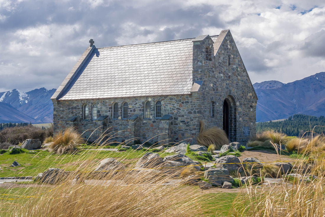 We left Wanaka Friday morning and drove through the Lindis Valley Pass and stopped at Omarama for lunch. Within an hour we had arrived at Mt Cook lookout which is on Lake Pukaki. It was a clear day and we had a great view of the snow-capped Mt Cook which is also known as Aoraki. It is the highest mountain in New Zealand at 3,724 metres. Aoraki means cloud piercer in Maori.
Lake Pukaki was a stunning colour. The turquoise blue of the lake is created by “rock flour.” The glaciers in the headwaters of Tekapo grind rock into fine dust on their journey down towards the lake. This rock flour is suspended in the water and when combined with sunlight creates the unique water colour.
It was another forty kilometre drive to Lake Tekapo. We stayed in The Chalet which provided wonderful views of the southern alps beyond Lake Tekapo.
Lake Tekapo is the home of The Church of the Good Shepherd. Like the little willow tree at Wanaka, this little church is much photographed by tourists from all over the world.
It was decided by Rev. W.E. Davies and local land holders in 1933 that there was a need for a church that would be a central meeting place, not only for the various station holders and their employees, but also for the many campers and holiday makers. The location chosen was the lakeside of Tekapo. This was the birth of the Church of the Good Shepherd at Tekapo. From the beginning it was decided that a feature of the church was to be a plate glass window behind the altar. This idea was first employed in the church at Franz Joseph on the west coast of New Zealand.
The church was to be sited to allow the window to frame the mountains and the lake. Also it was decided from its inception that the church was to be built “firstly to the glory of God and secondly, as a memorial to the pioneers of the district”.
After a very pleasant two night stay at Lake Tekapo, Sunday morning (day10) we will drive about 260 kilometres to Christchurch before we fly home on Monday afternoon.
]]>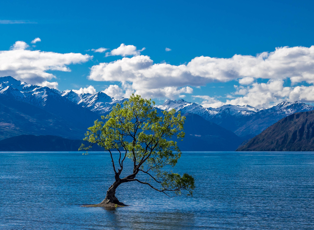 Thursday morning we left the rain of Dunedin and drove to Alexandra for lunch on our way to Wanaka. We enjoyed some very picturesque farmland. Wanaka is surrounded by mountains and is situated in the Otago region at the southern end of Lake Wanaka and overlooks Mt Aspiring National Park. It is primarily a resort town with both summer and winter seasons and was originally settled during the gold rush of the nineteenth century.
The weather was ideal to photograph Mt Aspiring and also the little willow tree which has become popular with photographers from all around the world. It is only small and grows in the water a few metres from the shore.
Wanaka's "willow with wet feet" is now New Zealand's most photographed tree. About five years ago, Wanaka photographers and writers began sending images of the tree through social media. Since then it has been posted on New Zealand tourism media and therefore has gained notoriety throughout the world. The tree started life in 1939 as part of a fence used to keep the sheep out of town. Its determination to live makes interesting reading. It is located in a gentle curve in Roys Bay opposite the showgrounds.
]]>
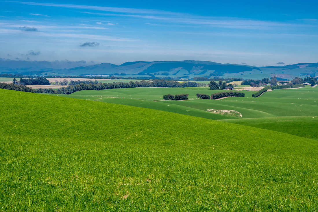 Day 6 we awoke to a very windy and wet Wednesday morning. We arrived in Dunedin the night before and are staying near the city centre. Not the most picturesque city but the day had only begun so I decided to reserve judgement.
We drove to the Albatross centre about 25 kilometres along the foreshores of Otago Harbour to view the male Albatross returning for mating season. Unfortunately it was too wet and windy to go on a tour so we then drove half an hour back towards Dunedin to visit Larnach Castle. This is New Zealand's only castle and was built in 1871 by William Larnach who was an Australian born banker, financier and merchant baron. In New Zealand he was a successful landowner and Minister of the Crown. Tragically, whilst seated alone in a committee room in parliament, he took his own life with a single pistol shot to the head. Events leading to this tragic event make very interesting reading. Larnach's lasting legacy was his great Castle overlooking the spectacular Otago Harbour.
The Castle fell into disrepair and in 1967, Margaret and Barry Barker purchased the empty, derelict Castle. Their wish was to restore and secure the survival of this historic Castle for future generations. The Castle is still owned by Barker family descendants and available for visitors and guests to enjoy.
In the afternoon, we visited the Dunedin Botanical Gardens which has many varied species of flora (see photos in gallery), a large greenhouse and an extensive aviary with a variety of birds including Australian parrots. Most enjoyable and we both agreed the day had turned out better than expected.
Thursday morning we will be driving almost 300 kilometres to Wanaka in the Central Otago area.
]]>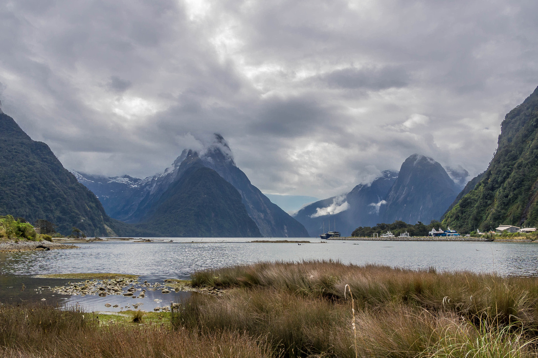 We left Te Anau Monday morning for a two hour drive to Milford Sound. Situated on the west coast (within Fiordland National Park) of the South Island, Milford Sound is a fusion of spectacular natural features. Along the way we went for some short walks and viewed cascading waterfalls and many snow capped mountain peaks. We arrived at 1 pm for a two hour cruise. It was quite overcast but our spirits weren't dampened as it soon became evident a visual feast awaited regardless of the weather.
Milford Sound is a fiord which is a long, narrow, deep inlet of the sea between high cliffs formed by submergence of a glaciated valley created by glacial erosion. Milford Sound runs 15 kilometres inland from the Tasman Sea. It is surrounded by sheer rock faces that rise 1200 metres or more on either side. It is known as the wettest place in New Zealand with an average annual rainfall of 252 inches.
About 15 kilometres from Milford Sound there is a 1.2 kilometre road tunnel which pierces the Darran Mountain range to enable access to Milford Sound. This tunnel was started in 1935 and took 19 years to complete.
Our cruise revealed many spectacular features such as waterfalls, seals basking on rocks and included viewing a lighthouse at the mouth of the Tasman Sea. we were fortunate to see some bird life such as a Weka near the information centre and a number of Kea's descended on our car as we were waiting to enter the tunnel on the return journey.
Rudyard Kipling had previously referred to Milford Sound as the eighth Wonder of the World. I gladly agree with that sentiment!
]]>
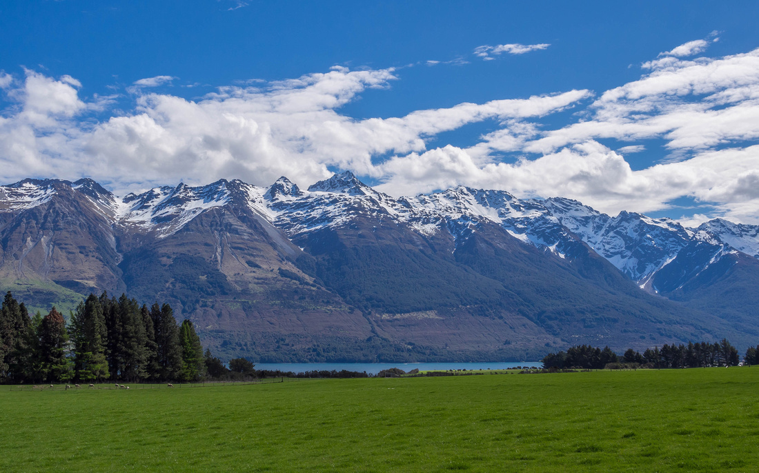
We arrived Queenstown Friday afternoon after a two hour flight from Sydney. Located in the southern lakes region of the South Island and surrounded by many beautiful mountains and situated on the edge of crystal clear Lake Wakatipu. The outstanding natural feature adjacent to Queenstown is the Remarkables mountain range. It is aptly named because it is one of only two mountain ranges in the world to run directly north to south - the other is the Rockies. Central Queenstown near the Pier, has a vibrant restaurant scene. It is very picturesque and well worth a visit.
On Saturday morning we drove 50Ks to Glenorchy which is a more peaceful, rural setting. I was fortunate to be able to take a few photos of a bride and groom after their wedding! We had glorious views of Lake Wakatipu and snow capped mountains along the way. Lake Wakatipu has a length of 80 kilometres and is New Zealand's longest lake and it's third largest.
Sunday morning we ascended 450 metres above Queenstown on the Skyline Gondola to the top of Bob's Peak. We had 220 degree views of Coronet Peak, The Remarkables, Walter Peak, Cecil Peak and of course over Queenstown.
As much as we enjoyed snow capped mountains and the busyness of Queenstown, it was now time for a leisurely two hour drive through some beautiful rural countryside before arriving at Te Anau, our accommodation for two nights to enable a visit to Milford Sound. Te Anau is a sleepy little tourist town in the Southland region and is on the eastern shore of Lake Te Anau in Fiordland. Lake Te Anau is the largest lake in the South Island and second only within New Zealand to Lake Taupo.
]]>
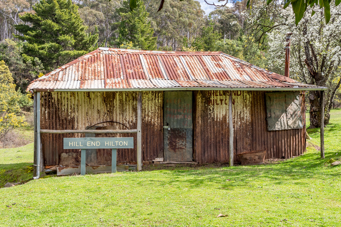 Tinker and I visited Hill End on 6 September 2016. On the way we visited the Motor Museum at Bathurst. Hill End is the remains of an old gold mining town town approximately one hours drive from Bathurst. In the 1870's rich gold discoveries rapidly turned Hill End from a small rural and mining community into one of the largest inland towns in NSW. We stayed overnight at Carla's Cottage which is about 10 kilometres from the Hill End township heading towards Mudgee.
The township is very small with many of the old buildings no longer standing. However, the pub and remaining buildings and churches give this small village a charming rustic feel to it. We went for a short drive nearing dusk and at one stage wondered if the Kangaroos outnumbered the locals!
Hill End is an idyllic little village well worth a visit for not only the historical signifigance but also the very pleasant drive from Bathurst. The return trip via Sofala, Ilford and Capertee was equally pleasing.
]]>
]]>